A disaster that killed 16 people and left 546 others unaccounted for at Gyirong Port in southwestern China's Xizang Autonomous Region has been traced to its origin: a glacier fracture high in Nepal's Himalayan peaks. Chinese authorities announced on Sunday that the catastrophic mudslide devastating the Gyirong area resulted from an ice-rock avalanche that originated from Mount Langtang Lirung, demonstrating how natural hazards in the world's highest mountain ranges can cascade across international borders with lethal consequences.
The chain of geological events began when a glacier situated on the south-facing slope of Mount Langtang Lirung fractured at approximately 5,200 metres elevation. This rupture, occurring in Nepali territory, unleashed an ice-rock avalanche that immediately began gaining momentum and destructive power as it descended the mountainside. The scale of this initial collapse appears to have been substantial, suggesting that the glacier had accumulated significant stress over an extended period before the sudden failure.
What makes this disaster particularly devastating is the transformation that occurred as the avalanche descended. Plunging down to around 4,000 metres, the falling ice and rock scoured the mountainside with tremendous force, dislodging additional material and saturating itself with water and soil. This process converted what began as a discrete avalanche into a massive debris flow—a high-velocity torrent of mixed material that acquired increasingly destructive power. The resulting flow maintained enough energy to travel an extraordinary distance of approximately 22 kilometres before reaching Gyirong Port, situated at 1,800 metres elevation.
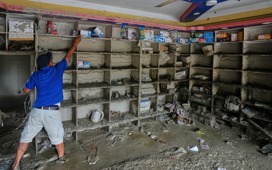
The impact at Gyirong Port proved devastating to the small settlement. The debris flow flattened an area covering roughly 0.7 square kilometres, obliterating 27 buildings and associated infrastructure. The sheer force required to destroy such substantial structures over such a wide area underscores the immense energy released by this natural catastrophe. Local residents and workers in the border town had little warning before the wall of debris arrived, reflecting the rapid progression of such flows once they reach lower elevations.
Chinese scientific authorities worked swiftly to determine the precise origin and mechanics of the disaster. The Institute of Mountain Hazards and Environment, operating under the Chinese Academy of Sciences, assembled a specialist cryosphere emergency disaster response team to investigate the incident. Their methodology combined multiple investigative approaches: analysis of remote-sensing satellite data provided continuous monitoring of the affected terrain, field-transmitted data offered real-time observations, and teams conducted extensive on-site surveys and investigations to document the physical evidence.
This cross-border natural disaster raises significant questions about transnational hazard management in the Himalayan region. The Langtang area of Nepal, situated just north of the Kathmandu Valley, sits at the convergence of complex geological and climatic systems. Climate change appears to be destabilizing glaciers throughout the Himalayas at an accelerating pace, potentially increasing the frequency of such catastrophic failures. For Southeast Asian nations, this serves as a sobering reminder that environmental degradation in distant mountain regions can generate consequences extending across borders and affecting distant populations.
The disaster underscores the vulnerability of settlements positioned downstream from alpine terrain. Gyirong Port functions as a significant trading post along the Nepal-China border, making it strategically important to both nations. The destruction of 27 structures and the loss of life suggest that this was not merely a remote mountain incident but rather an event affecting populated areas dependent on cross-border commerce and connectivity. The missing persons count of 546 as of Saturday evening represents a substantial portion of the settlement's population, indicating severe disruption to community life.
For Malaysia and Southeast Asia more broadly, this disaster serves as a cautionary case study about the interconnected nature of environmental hazards in Asia's great mountain systems. The Himalayan glaciers ultimately feed the major river systems of the region, including the Mekong, which flows through multiple Southeast Asian nations. As these glaciers destabilize, the potential for catastrophic events increases, alongside concerns about long-term water security for populations downstream. The Gyirong incident demonstrates that this is not a theoretical concern but a present-day reality.
The investigation conducted by Chinese scientists provides valuable technical data for understanding how avalanches and debris flows function across extreme terrain. Such knowledge proves essential for developing early warning systems, planning evacuation procedures, and designing infrastructure resilient enough to withstand or divert such events. The cooperation implied in the cross-border investigation—with Chinese experts presumably reviewing terrain and data from the Nepali side—suggests potential frameworks for improved regional coordination on natural disaster preparedness.
The humanitarian toll continues to accumulate as rescue operations proceed and missing persons are accounted for. Beyond the immediate casualties, the destruction of 27 buildings represents significant economic loss and community disruption. Gyirong Port will require substantial reconstruction effort, and the incident may have lasting effects on cross-border trade flows and community confidence in the region's stability. For residents and traders dependent on this route, the event crystallizes the environmental risks inherent in high-altitude border regions.

