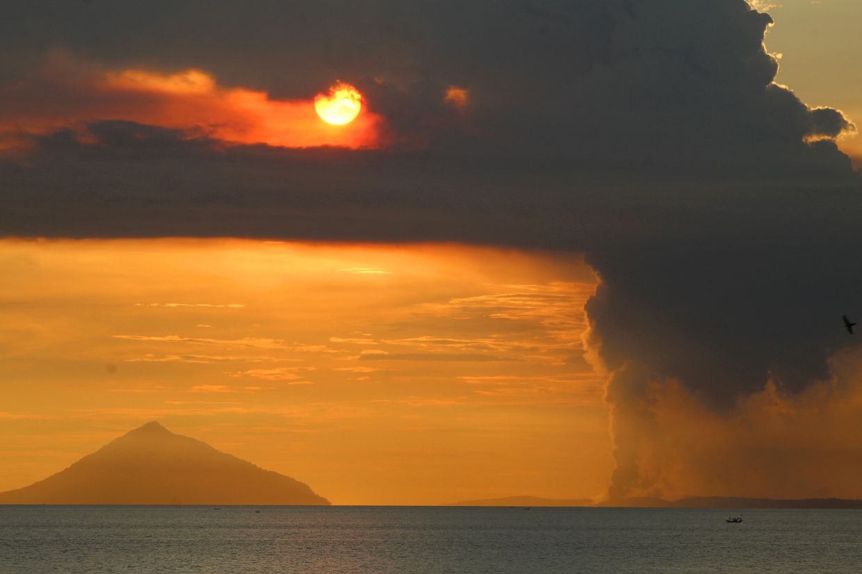
Mount Anak Krakatau, the volcano that has emerged as a major concern for regional authorities, erupted during the early morning hours of Tuesday, July 7, discharging an ash column approximately 100 metres into the atmosphere above the Sunda Strait. The eruption, which began at 8:21 a.m. local time according to Indonesia's Geological Agency of the Energy and Mineral Resources, marked the fifth explosive event since the volcano entered its current eruptive phase. The dense ash plume drifted north-westward from the crater as seismic instruments recorded a maximum amplitude of 11 millimetres with an event duration lasting roughly 15 seconds, confirming that the volcano continues to flex considerable geothermal muscle.
The incident underscores the growing volatility of this relatively young volcano, which has demonstrated increasingly frequent seismic signals over the past month. Andi Suwardi, head of the Mount Anak Krakatau Observation Post located in South Lampung, confirmed that despite Tuesday's eruption, the official alert classification has not changed. The volcano remains fixed at Level III (Watch), the second-highest tier within Indonesia's four-category volcanic alert framework. Suwardi emphasised that 24-hour surveillance teams stationed at the observation post maintain continuous vigilance, tracking critical parameters including ash plume dimensions and earthquake magnitudes to detect any shifts warranting a further escalation.
What makes the current situation particularly noteworthy is the dramatic acceleration in seismic unrest preceding this week's eruption. From June 10 onwards, the volcano's behaviour shifted markedly after an extended quieter period. By mid-June, specifically between June 18 and 19, scientists documented a surge in eruption tremors and low-frequency earthquake events, with daily averages exceeding 50 occurrences. This crescendo continued through late June and into early July, with frequencies climbing to an average of 97 events per day between June 16 and July 2—a pattern that clearly signalled mounting magmatic pressure beneath the volcano's surface.
Responding to this escalating geological unrest, Indonesia's Geological Agency made the decision on Friday to elevate the volcano's status from Level II (Alert) to Level III (Watch), thereby tightening restrictions on public access. The authority simultaneously established a three-kilometre exclusion perimeter around the crater zone, effectively prohibiting civilian entry to the immediate vicinity. This regulatory framework aims to minimise the exposure of potential victims should the volcano transition to a more catastrophic eruption phase or trigger secondary hazards such as pyroclastic flows or lahars.
Yet despite official warnings and the exclusion boundary, enforcement challenges persist in this geographically remote region. Reports indicate that some fishermen and tourism operators continue to venture into restricted waters near Mount Anak Krakatau, apparently attempting to circumvent monitoring by government authorities. These individuals, driven by economic necessity and the lucrative income opportunities associated with fishing and tourism in these waters, have demonstrated a willingness to accept substantial personal risk. South Lampung Regent Radityo Egi Pratama publicly appealed to these communities to abandon their activities in the volcano's vicinity, acknowledging the economic hardship while prioritising collective safety.
The tension between livelihood and safety reflects broader challenges facing Indonesia's volcanic communities. Egi recognised that heightened volcanic activity has substantially impacted local economies dependent on maritime resources and tourism revenue. However, he firmly asserted that public welfare must take precedence, calling for fishermen and tour operators to voluntarily withdraw from the danger zone until such time as scientists determine the volcanic threat has sufficiently diminished. This appeal represents a delicate balance between economic compassion and catastrophe prevention that regional administrators must navigate.
Understanding the historical context of Mount Anak Krakatau illuminates why such precautions, however economically burdensome, remain absolutely essential. This volcano represents a unique geological phenomenon—it literally emerged from the sea in 1927 within the caldera left behind by the cataclysmic 1883 eruption of Mount Krakatau, one of history's most devastating volcanic disasters. That nineteenth-century event unleashed thunderous explosions and cascading tsunamis that claimed an estimated 36,000 lives across the region. The eruption's violence proved so immense that it ejected enormous quantities of ash and gases into the stratosphere, cooling global temperatures and fundamentally disrupting atmospheric circulation patterns that influenced weather systems worldwide.
More recently, Mount Anak Krakatau itself demonstrated its destructive potential on December 22, 2018, when a partial flank collapse triggered a tsunami that ravaged coastal communities in southern Sumatra and western Banten. That disaster killed at least 429 people and injured more than 7,200 additional victims, demonstrating that this comparatively young volcano harbours sufficient energy to generate widespread tragedy. The proximity of millions of Indonesians and international travellers to this volatile system, combined with its proven capacity for multiple hazard types—including explosive eruptions, tsunamis, and pyroclastic activity—justifies the maintenance of heightened vigilance.
Indonesia's volcanic monitoring infrastructure represents a sophisticated attempt to mitigate these inherent risks through early detection and public warning systems. The Geological Agency's decision to classify Mount Anak Krakatau at Level III status reflects scientific consensus that the volcano has crossed a threshold of instability requiring strengthened public protection measures. The three-kilometre exclusion zone provides a buffer intended to safeguard human life from the most immediate hazards, though as recent incidents demonstrate, this geographical shield proves only as effective as public compliance permits.
For Malaysian readers and Southeast Asian observers, Mount Anak Krakatau's renewed activity carries particular resonance given the region's interconnected maritime environment and shared vulnerability to transboundary volcanic hazards. The 2018 tsunami that followed Anak Krakatau's flank collapse spread across the Sunda Strait and beyond, affecting populations across multiple national jurisdictions. Should the volcano escalate to major eruptive or collapsing phases, Indonesian communities would face immediate threats, but regional maritime traffic, coastal populations in Malaysia and Singapore, and tourism industries throughout Southeast Asia could experience consequential secondary effects ranging from ash fall to tsunami propagation.
The situation surrounding Mount Anak Krakatau exemplifies the ongoing tension between natural hazard risk and human economic imperatives that characterises life across the Pacific Ring of Fire and similar seismically active regions. Indonesian authorities have correctly prioritised safety by maintaining strict monitoring protocols and enforcing exclusion zones, yet they simultaneously recognise the genuine hardship imposed on vulnerable fishing and tourism communities dependent on the volcano's surrounding waters. As volcanic tremors continue and scientists observe the volcano's evolving behaviour, the hope remains that the current phase represents a temporary spike in activity rather than a precursor to a major eruption, allowing communities eventually to resume their livelihoods once geological conditions stabilise.

