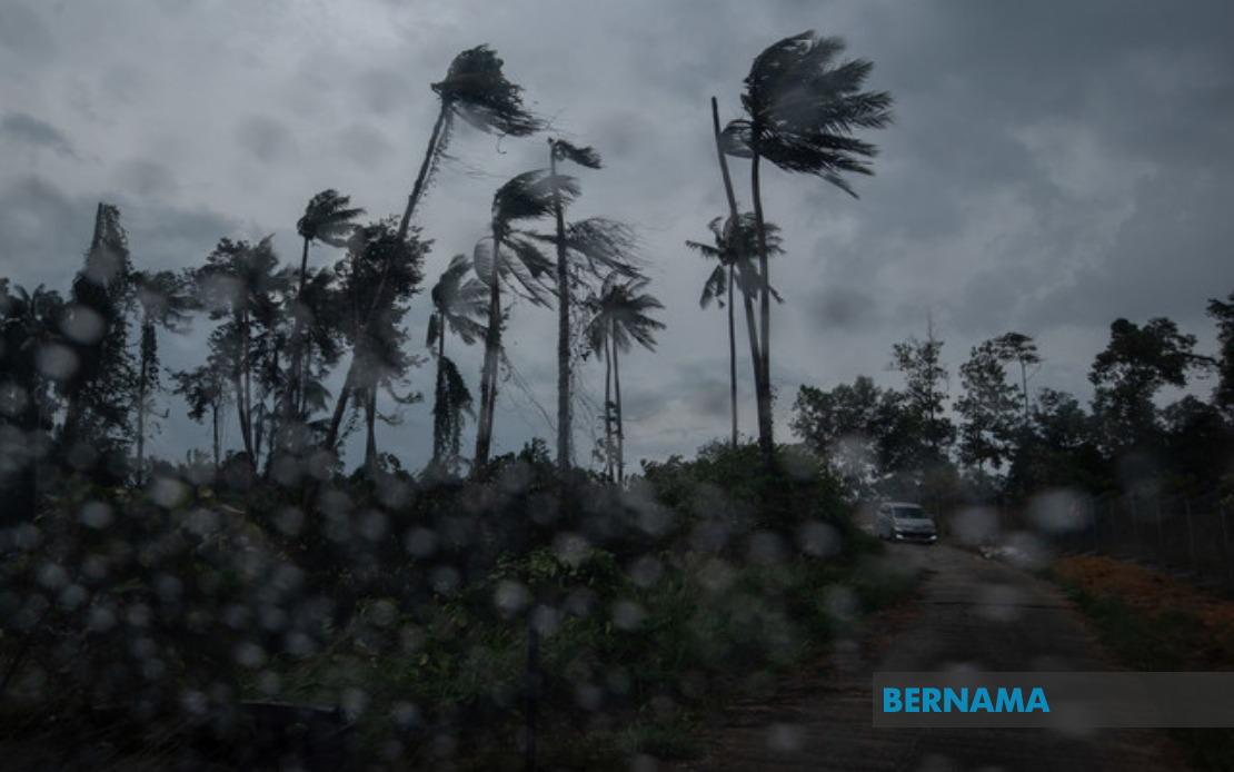
The Malaysian Meteorological Department (MetMalaysia) has cautioned the public against severe weather conditions expected to persist throughout several regions of the country until 6 pm, with forecasters warning of thunderstorms accompanied by heavy precipitation and potentially dangerous gusts of wind. The alert encompasses a substantial geographical area spanning the peninsula's eastern seaboard, central regions, and both the federal territories of Sabah and Sarawak in Malaysian Borneo.
On the peninsula's northern flank, Langkawi in Kedah faces the brunt of the incoming weather system. Across the Perak region, multiple districts including Kinta, Perak Tengah, Kampar, Hilir Perak, Batang Padang and Muallim are all under the warning. The extent of the alert on the east coast is particularly noteworthy, with Kelantan experiencing the most comprehensive coverage—affecting Tumpat, Pasir Mas, Kota Bharu, Jeli, Tanah Merah, Bachok, Machang, Pasir Puteh and Kuala Krai. Similarly, the adjacent state of Terengganu has four districts on alert: Besut, Setiu, Kuala Nerus and Kemaman.
Pahang, Malaysia's largest peninsular state, faces widespread weather disruption with nine locations covered by the meteorological alert. The warning extends across the highland regions of Cameron Highlands, through central districts such as Lipis, Raub and Bentong, and down to the eastern lowlands including Kuantan, the state capital. Additional areas such as Bera, Pekan and Rompin round out the comprehensive coverage for Pahang. This broad warning pattern reflects the weather system's intensity and unpredictable trajectory as it moves across the region.
The central belt of Peninsular Malaysia is not exempt from the forecast, with Hulu Selangor and Gombak in Selangor both under alert status. These areas, which fall within or adjacent to the Klang Valley metropolitan region, may experience disruptions to transportation and daily activities should heavy downpours materialise as predicted. In the southern Selangor corridor, the proximity to major urban and industrial centres means that even brief but intense rainfall could trigger localised flooding in low-lying areas.
Negeri Sembilan has been assigned a partial alert, covering Jempol and Tampin in the southern portions of the state. Further south, Johor presents a significant swath of affected districts stretching from Tangkak in the north through Segamat, Kluang, Mersing and down to Kota Tinggi. This extensive coverage in Johor reflects the breadth of the weather system affecting the nation's southern peninsula.
In East Malaysia, Sabah's Interior Division bears the brunt of the alert, with Sipitang, Tenom, Beaufort, Keningau and Tambunan all under warning. The state's West Coast districts of Papar, Putatan, Penampang, Kota Kinabalu and Tuaran—comprising the state's most densely populated region—are similarly affected. The alert extends eastward to Lahad Datu in the Tawau Division and Kinabatangan in Sandakan, demonstrating the weather system's broad impact across Sabah's diverse geography.
Sarawak, Malaysia's largest state by land area, faces alerts in three separate locations. The warning covers Tatau and Sebauh in the Bintulu Division, Subis in the Miri Division near the Brunei border, and Limbang in the northernmost region. The scattered distribution of affected areas in Sarawak suggests a more localised weather system compared to the more contiguous alerts seen on the peninsula and in Sabah.
The combination of thunderstorms, heavy precipitation and strong winds poses multifaceted risks to the affected regions. Thunderstorms can develop rapidly and unpredictably, creating hazardous conditions for motorists and outdoor enthusiasts. Heavy rainfall accumulation, particularly in hilly or already-saturated terrain, raises the prospect of flash flooding and landslides—concerns that are especially acute in areas such as Cameron Highlands and the interior Sabah districts where topography amplifies water runoff. Strong winds accompanying the system could potentially cause structural damage to buildings and vegetation, and may disrupt utilities.
For residents and businesses across these affected districts, the alert serves as a notice to exercise heightened caution during the warning period. Travellers should consider postponing non-essential journeys, particularly across highland passes or coastal routes where visibility may be severely compromised. School and university authorities may need to assess whether outdoor activities should be suspended or relocated indoors. Farmers and agricultural operators should take precautions to protect crops and livestock from exposure to the elements.
The geographical diversity of the affected areas—spanning urban centres, agricultural zones, highland terrain and coastal plains—means that the impact of the severe weather will vary considerably depending on local conditions and existing drainage infrastructure. Urban areas with developed storm water management systems may fare better than rural regions or informal settlements where drainage is inadequate. This disparity underscores the importance of localised community preparedness and early warning dissemination through multiple communication channels to ensure that vulnerable populations receive timely information.
MetMalaysia's issuance of this alert reflects the department's ongoing monitoring of atmospheric conditions and its commitment to public safety through advance warning of hazardous weather. The specific time window until 6 pm suggests that meteorologists anticipate the system's peak intensity during the afternoon hours, a pattern consistent with the heating of the land surface during daylight hours triggering atmospheric instability. Residents and authorities are encouraged to remain vigilant, keep weather updates readily accessible, and ensure that emergency response teams and disaster management units remain on standby throughout the warning period.

