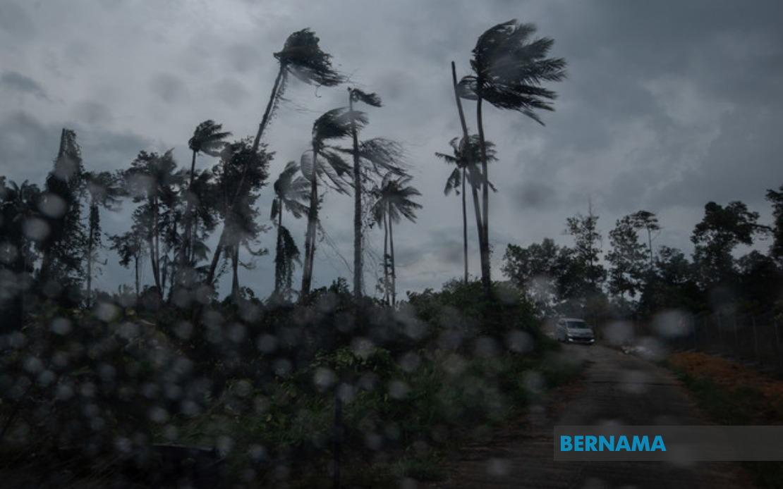
Malaysia's weather authorities have activated a nationwide alert system following the emergence of severe atmospheric conditions affecting both populated urban centres and regional towns across the country. The Malaysian Meteorological Department released the warning at 8.35 am, cautioning residents and commuters to prepare for sudden deterioration in weather conditions lasting until the early afternoon hours.
The alert encompasses a broad geographical footprint across Peninsular Malaysia, where entire states face exposure to the forecasted weather phenomenon. Perlis and Melaka represent the most comprehensively affected regions, with the entire land area of both states falling within the warning zone. The northern state of Kedah experiences partial coverage, with three districts specifically identified—Langkawi, Kubang Pasu and Kota Setar—representing the most vulnerable locations for residents and businesses operating in these areas.
Eastern seaboard communities in Pahang face significant weather disruption, with three major urban and semi-urban centres positioned in the warning radius. Kuantan, the state capital and the largest population centre, stands alongside Pekan and Jerantut as zones where thunderstorms and accompanying precipitation are likely to develop with minimal notice. Similarly, the Selangor conurbation experiences targeted alerts for Sepang and Kuala Langat, two strategically important areas given their proximity to Kuala Lumpur International Airport and major transportation corridors linking the federal territories to the southern regions.
Negeri Sembilan's warning coverage demonstrates the unpredictability of the weather system, encompassing five separate districts rather than blanket state coverage. Port Dickson, situated along the western coastline, faces particular exposure to wind-driven hazards alongside the inland municipalities of Seremban, Rembau, Kuala Pilah and Tampin. Johor's southern districts of Tangkak and Muar round out the Peninsular warning zones, suggesting the storm system maintains significant spatial extent and organisational complexity.
East Malaysia's Sarawak state has likewise attracted meteorological concern, with nine separate districts positioned within the forecast warning area. The Mukah and Selangau districts anchor the coastal exposure, while Sibu and Sarikei represent major commercial and population centres likely to experience disruption. The interior and northern zones encompassing Maradong, Bintulu, Kapit, Bukit Mabong and Subis in Miri extend the warning coverage across Sarawak's diverse geographical terrain, from coastal zones to jungle-fringe communities.
The nature of the meteorological threat encompasses three distinct hazards working in combination to create dangerous conditions. Thunderstorms produce sudden lightning strikes capable of causing casualties and infrastructure damage, while heavy rainfall threatens localised flooding, particularly in low-lying areas and communities with inadequate drainage infrastructure. Strong winds accompanying these systems pose risks to exposed structures, vegetation and moving vehicles, with particular danger on highways and elevated routes where wind gusts can compromise vehicle stability.
MetMalaysia classified this as a short-term weather advisory, a designation indicating validity for periods not exceeding six hours with each successive bulletin. This classification reflects the rapidly evolving nature of the atmospheric conditions and the difficulty meteorologists face in producing extended forecasts for severe weather phenomena. The six-hour validity window necessitates that affected residents monitor subsequent updates closely, as conditions may intensify, migrate geographically or dissipate faster than initially anticipated.
For Malaysian commuters and business operators, such alerts carry significant operational implications. Public transportation authorities typically implement contingency protocols upon receipt of severe weather warnings, potentially adjusting schedules or service frequencies in response to forecast conditions. Construction sites and outdoor industrial operations face pressure to suspend work or implement protective measures safeguarding personnel and equipment. Schools and educational institutions in affected zones may adjust dismissal procedures or implement shelter-in-place protocols depending on warning intensity and timing.
The geographic spread of this particular alert illustrates a weather pattern of considerable scale and significance. Rather than reflecting isolated local thunderstorm activity, the simultaneous issuance of warnings across nine Peninsular districts plus nine Sarawakian districts suggests an organised pressure system or frontal boundary traversing Malaysian airspace. Such patterns typically develop when monsoon influences or tropical convergence zones interact with the peninsula's complex topography and coastal geometries.
For residents in alert zones, precautionary measures include securing loose outdoor items, avoiding unnecessary travel during peak warning periods, and remaining indoors during the most intense conditions. Motorists should exercise heightened caution, particularly on routes known for water accumulation or wind exposure. Communities with previous flood experience warrant particular vigilance, as saturated soils from prior rainfall increase susceptibility to additional precipitation.
The Malaysian Meteorological Department's alert system represents a crucial public safety mechanism, providing advance notification that allows individuals and organisations minimal but potentially life-saving preparation time. While the six-hour validity window reflects meteorological uncertainty inherent in short-range forecasting, the issuance of such warnings demonstrates the department's commitment to disseminating available information rapidly to affected populations.

