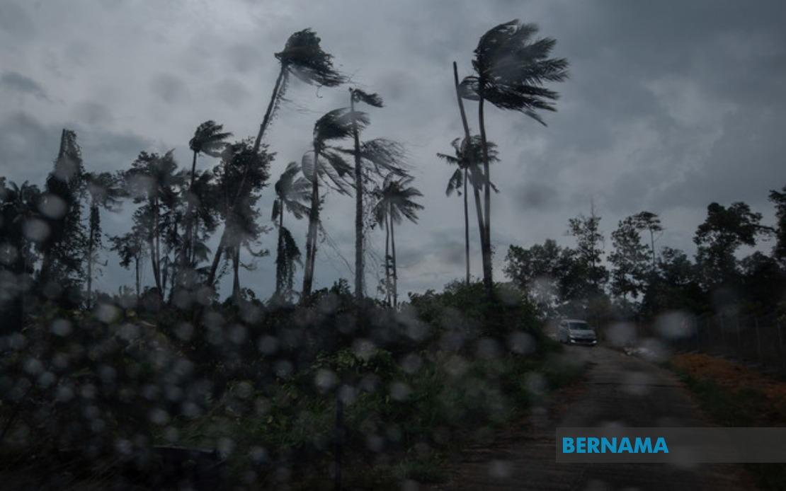
The Malaysian Meteorological Department issued a weather alert at 2.40 pm on August 19 cautioning that nine states across the nation face an elevated risk of thunderstorms, torrential downpours, and dangerous gusts of wind extending through 5 pm. The advisory comes as the country enters its monsoon transition period, when atmospheric instability typically intensifies across multiple regions simultaneously, creating conditions favourable for the rapid development of convective weather systems.
In the northern corridor, Kedah bears the brunt of the warning, with six districts positioned directly in the storm's path: Baling, Sik, Kulim, Kuala Muda, Pendang, and Yan. Neighbouring Penang faces similar threats, though the alert covers only the two northern subdivisions of Seberang Perai Utara and Seberang Perai Tengah. These states, lying on the windward side of the peninsula, regularly experience enhanced rainfall during monsoon-influenced weather patterns, making them particularly vulnerable to flash flooding and surface water accumulation in low-lying areas.
The alert extends southward through Perak, where seven districts have been flagged: Mualim, Kinta, Kampar, Batang Padang, Perak Tengah, Hilir Perak, and Kuala Kangsar. This extensive coverage reflects Perak's geographic positioning across multiple weather zones, with some areas benefiting from orographic lifting effects as moist air masses encounter topographical barriers. The state's terrain, characterised by river valleys and highland regions, can channel and concentrate rainfall, amplifying flood risks even when precipitation amounts appear moderate on paper.
On the east coast, Terengganu and Pahang both feature prominently in the warning bulletin. Terengganu's four affected districts—Dungun, Marang, Kuala Terengganu, and Kuala Nerus—represent the state's most densely populated and economically significant zones, encompassing the state capital and major coastal municipalities. Pahang's inclusion is more geographically diverse, spanning eight districts from the highland region of Cameron Highlands through the central districts of Lipis, Raub, and Bentong, extending eastward to the coastal and inland zones of Rompin and Temerloh. This sprawling coverage underscores how thunderstorm systems in this region can affect vastly different terrain types simultaneously.
The central region of Peninsular Malaysia sees Negeri Sembilan placed under alert, with five districts identified: Seremban, Jempol, Tampin, Kuala Pilah, and Jelebu. Meanwhile, Johor's inclusion appears somewhat isolated geographically, with only Segamat receiving the warning designation. This fragmented coverage in the southern peninsula suggests that the meteorological conditions triggering the alert display the typical patchwork nature of equatorial thunderstorm systems, which often develop in isolated pockets rather than blanket entire states uniformly.
East Malaysia features prominently in the advisory, reflecting how monsoon dynamics extend across the region with considerable force. Sarawak's warning encompasses Miri (specifically the Marudi area), Limbang, Mukah, and three separate subdivisions spanning Sibu, Sarikei, and Bintulu. These six geographic zones represent Sarawak's primary populated and commercial corridors, including the state's northern oil-producing regions and central river-based communities. Sabah's affected areas concentrate on three distinct zones: the Interior Division encompassing six districts from Keningau through Beaufort, the West Coast region, and the northern tip around Kota Marudu (including Kota Marudu proper). These coverage areas reflect Sabah's complex microclimatic patterns, where interior highland regions experience vastly different weather from coastal lowlands.
Thunderstorm warnings carry significant practical implications for residents and businesses across these regions. Heavy rainfall can trigger flash flooding in drainage-prone areas, potentially isolating communities and disrupting transportation networks. Strong wind gusts pose hazards to structures, vehicles, and outdoor activities, while lightning strikes represent a genuine safety concern for those exposed outdoors. The afternoon timing of the warning—extending through 5 pm—aligns with the diurnal heating cycle that typically intensifies convective activity during late afternoon hours, though evening thunderstorm activity can persist considerably longer than forecast in some instances.
For agricultural interests across these states, untimely thunderstorms during harvest periods can damage crops and complicate field operations, while excess water damages drainage infrastructure on farms. Fisheries operators along both peninsular and Bornean coasts may alter their schedules in response to adverse sea conditions accompanying the storm system. The tourism and hospitality sectors in popular destinations like Cameron Highlands, Kuala Terengganu, and Miri may experience disruptions to outdoor activities and transportation schedules.
MetMalaysia's advance warning system allows authorities and individuals adequate preparation time, though the narrow five-hour window means responses must be relatively immediate. State disaster management agencies typically activate monitoring protocols, ensuring that emergency services remain positioned to respond to weather-related incidents. The department's geographic specificity—identifying precise districts rather than merely naming states—reflects modern meteorological capabilities and enables more targeted preparedness measures at municipal and community levels.
The frequency of such alerts during Malaysia's monsoon seasons underscores the nation's location within the tropical convection zone, where atmospheric conditions routinely favour severe weather development. Understanding these patterns remains essential for infrastructure planning, agricultural scheduling, and emergency preparedness across all affected regions. Residents are advised to remain attentive to updated warnings, as meteorological conditions can change rapidly during the monsoon transition periods.

