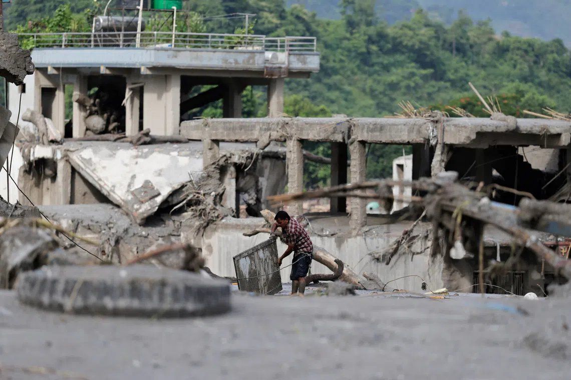
The Himalayan borderlands shared by Nepal and China face a mounting crisis as attention shifts from the catastrophic flooding unleashed Wednesday to the emerging threat posed by secondary natural dams that could unleash fresh waves of destruction across vulnerable mountain communities. Officials in both nations issued urgent cautions on Thursday regarding two expansive bodies of water that have formed in the aftermath of a massive glacier collapse, warning that the accumulating volume behind these debris-choked barriers poses serious risks of breakthrough and downstream inundation. This cascading hazard underscores the complex geological aftermath of disaster in high-altitude terrain, where initial destruction often paves the way for secondary catastrophes that can prove equally devastating.
The disaster that struck the border region between Nepal and Tibet has already claimed at least 362 lives, with search and rescue teams still operating frantically through debris-laden valleys and across treacherous hillsides in a race against fading hopes of locating over 1,000 individuals reported missing since Wednesday's event. The sheer scale of human loss reflects the violence of the original phenomenon: a glacier rupture that released vast quantities of rock, ice, mud and other material into river networks, transforming seasonal waterways into torrential channels of destruction. Workers remain engaged in exhausting and perilous operations across both territories, though the emerging threat of secondary flooding has begun forcing teams to reassess their positioning and tactics.
Nepal's disaster management authority moved quickly to alert populations in vulnerable lower valley zones after observing the formation of a substantial debris dam across a river channel at the primary disaster site. The warning conveyed by the authority emphasized the dynamic nature of this developing threat, noting that the water level behind the debris barrier has been rising progressively. Official guidance recommended that residents, particularly those occupying areas downstream, maintain heightened vigilance and position themselves at safer elevations away from river corridors and other identified risk zones. The authority's cautious framing acknowledged that while the dam remains intact, the accumulating hydrostatic pressure behind it represents a genuine and escalating threat.
China's assessment of its side of the cross-border situation revealed numerical dimensions that heighten concern about the secondary flooding hazard. Water resources authorities in Beijing calculated that approximately 3 million cubic meters—a volume equivalent to roughly 1,200 Olympic-sized swimming pools—is projected to flow into a pre-existing dammed lake on the Chinese side of the frontier over a three-day window. This influx would introduce substantially more water into a system already constrained by physical infrastructure, generating conditions favorable for catastrophic spillage or structural failure. The Chinese water resources ministry projected that the period of maximum inflow pressure would occur around September 1, providing a narrow window for mitigation efforts and population preparation.
Meteorological forecasts add another layer of complexity to the unfolding situation, with rainfall predictions for the coming week threatening to intensify hydrological pressures across the affected region. State media reports citing China's water resources ministry emphasized that incoming precipitation would further boost water volumes in the threatened lakes and dammed systems, accelerating the timeline toward critical conditions. Zhu Jinfeng, a specialist at the hydrology department within the water resources ministry, articulated the escalating concern in comments broadcast on state media, noting the reciprocal relationship between rising water volume and mounting risk of catastrophic failure. His assessment conveyed a sense of urgency that extended beyond mere technical observation to emphasize the progressive nature of the hazard.
The dual-nation character of this emerging crisis creates distinctive coordination challenges, as authorities must align communication channels and mitigation strategies across national borders while managing different operational protocols and resource availability. Nepal's rescue contingents, already stretched thin by the scale of the initial disaster response, faced difficult decisions about repositioning personnel away from active search zones in order to avoid exposure to secondary flooding. Pawan Koirala, a rescue worker leading a team of thirteen individuals, exemplified the precarious position confronting emergency responders—balancing the imperative to locate survivors against the mounting risk that rescue operations themselves could be eliminated by subsequent inundation. The decision to withdraw rescue teams from river-proximate zones represents a painful acknowledgment that the disaster landscape continues to evolve in directions beyond immediate human control.
The phenomenon of secondary flooding generated by glacier collapse debris dams carries particular significance for Himalayan communities, where such cascading natural hazards have historically proven capable of compounding initial destruction and complicating recovery efforts. The formation of temporary dams by glacial debris occurs with relative frequency in these high-altitude regions, but the contemporary example combines unusual scale with confluence of other meteorological and hydrological factors. Scientific understanding of these processes remains incomplete, particularly regarding the precise trajectory and timing of potential dam failures, which can occur suddenly and without extensive warning. This epistemic uncertainty creates acute difficulties for emergency management authorities attempting to issue precise guidance and coordinate evacuation procedures.
For Malaysia and other Southeast Asian nations, the situation in Nepal and Tibet carries implications extending beyond immediate humanitarian concern. The region's water systems feed into major river networks that ultimately support populations and economies downstream across South Asia, including areas within Southeast Asia's sphere of hydrological and geopolitical influence. Catastrophic secondary flooding could disrupt cross-border water systems and generate refugee movements, requiring regional coordination on disaster response and humanitarian assistance. The event also highlights the vulnerability of Asian mountain regions to climate-influenced glacier instability and the potential for accelerating frequency of such disasters in coming decades as global warming reshapes Himalayan glaciology.
Both Nepal and China have mobilized significant resources toward monitoring the threatened lakes and preparing contingency responses, though the technical challenges of intervening in high-altitude, glacier-affected terrain remain formidable. Water authorities are tracking inflow rates, water levels, and structural integrity of the debris dams with specialized equipment, attempting to generate sufficient advance warning if breaching appears imminent. Engineering teams have theoretically considered interventions such as controlled discharge to reduce pressure behind dams, but such operations in active disaster zones and complex mountain topography present extreme logistical difficulties. The authorities' repeated warnings to populations and rescue operations reflect the reality that prevention remains uncertain and preparedness constitutes the most viable strategy for minimizing casualties from secondary flooding.

