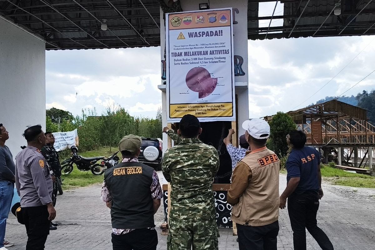
Tourism infrastructure in Indonesia's North Sumatra province has been shuttered indefinitely as authorities respond to escalating volcanic unrest at Mount Sinabung, one of Southeast Asia's most active and unpredictable volcanoes. The Karo regency administration ordered the closure of Lau Kawar Lake and its adjacent camping facilities in Kuta Gugung village, Naman Teran district, commencing August 19. The decision reflects mounting concern over a surge in seismic tremors and gas emissions recorded over recent days, prompting the government's disaster mitigation agencies to implement precautionary measures aimed at protecting both residents and visitors in the region.
Official justification for the shutdown came from Juni Antomi Kemit, head of the Karo Youth Affairs, Sports and Tourism Agency, who cited recommendations from the Vulcanology and Geological Disaster Mitigation Center's dedicated monitoring post. The regency had previously issued a public notice on August 14 urging all civilians, holidaymakers, and mountaineers to refrain from any activities in the vicinity of Mount Sinabung. According to Kemit, the temporary suspension of recreational facilities represents a prudent safety protocol given the volcano's current behavioural patterns, though no definitive timeline has been established for when normal operations might resume.
The elevation of Mount Sinabung's hazard classification marks a significant escalation in official concern. Armen Putra, the monitoring post commander, confirmed the alert level had been upgraded from Level I Normal to Level II Waspada—the advisory tier within Indonesia's four-tier volcanic alert system. This transition carries substantial implications for activity restrictions in surrounding communities. Authorities now recommend that civilians and tourists avoid any presence within three kilometres of the summit, with the restricted zone expanding to 4.5 kilometres in the South-East sector, where topography funnels potential pyroclastic flows and ashfall patterns. The advisory issued August 13 extends particular caution to communities residing along waterways fed by streams originating on the mountain, warning of sudden mudflow events that commonly accompany volcanic unrest in tropical regions.
Raw instrumental data underpinning this alert upgrade reveals a volcano entering a distinctly restless phase. Putra reported that thick plumes of volcanic smoke were rising 100 to 800 metres above the summit, while seismic tremors remained variable rather than stabilizing. By early Thursday morning, the monitoring network had detected five volcanic earthquakes originating from within the mountain, alongside multiple tectonic earthquakes—a marked increase from Wednesday's count of one volcanic and seven tectonic events. Volcanologists recognize the frequency and character of earthquakes as a principal bellwether for imminent eruption potential, with Putra explicitly noting that escalating seismic activity proportionally elevates the probability of a major discharge event.
Mount Sinabung's volcanic record over the past 13 years reveals a pattern of dramatic cycles punctuated by prolonged intervals of relative dormancy. The 2,460-metre peak remained quiescent for approximately four centuries before its initial modern eruption on August 29, 2010, after centuries of silence. Activity waned through September of that year, only to flare again in mid-September 2013, then dramatically intensify in November 2013 when authorities raised the alert to the maximum Level IV Awas designation. That November eruption unleashed pyroclastic flows—superheated avalanches of gas and rock—that claimed dozens of lives and forced the evacuation of populations from 21 villages and two smaller settlements across a broad region.
The volcano persisted in episodic eruptions throughout the subsequent six-year period, maintaining elevated threat levels across multiple communities. A gradual decrease in activity prompted authorities to lower the alert classification to Level III Siaga in May 2019, following instrumental and visual analysis suggesting diminished hazard. However, this apparent reprieve proved temporary. On July 28, 2021, Mount Sinabung unleashed its most recent major eruption, propelling volcanic ash columns to 4,500 metres altitude and extending pyroclastic flows across 1,000 metres in the east-southeast direction. Thick layers of ash blanketed at least five districts, disrupting livelihoods, infrastructure, and agricultural productivity across a wide region. This 2021 event culminated an 11-year period of continuous volcanic activity, marking the most significant discharge in that extended episode.
The current alert elevation carries particular significance for Southeast Asia's broader volcanic landscape and regional disaster preparedness frameworks. Mount Sinabung's volatile behaviour exemplifies the hazards facing populations across the Ring of Fire, where tectonic processes concentrate seismic and volcanic risk. For Malaysian authorities and regional disaster management agencies, the Indonesian experience provides operational lessons regarding early warning protocols, community evacuation procedures, and cross-border atmospheric monitoring, particularly regarding ash dispersal that can affect neighbouring nations. The closure of tourism infrastructure demonstrates how economic activities face periodic disruption in volcanically active regions, a consideration fundamental to sustainable development planning in Southeast Asia.
The implications for local communities extend beyond immediate safety concerns. Karo regency's economy depends substantially on tourism revenue derived from Mount Sinabung's scenic caldera lakes, trekking trails, and cultural attractions. Indefinite closure of flagship sites like Lau Kawar Lake represents tangible economic hardship for guide operators, hospitality workers, and vendors dependent on visitor expenditure. Historical precedent suggests such closures may persist for months, as authorities typically maintain restrictions until seismic networks confirm sustained reductions in activity frequency and intensity. The unpredictability of Mount Sinabung's cycle—erupting without warning after prolonged dormancy—complicates long-term business planning and investment decisions throughout the affected region.
Monitoring agencies face the considerable challenge of distinguishing transient volcanic unrest from genuine precursors to major eruption, a distinction that determines whether alert levels should escalate further or gradually decline. Volcanic seismic patterns, particularly the character of earthquakes and their depths, provide crucial diagnostic information, yet interpretation remains subject to uncertainty. The monitoring command post will continue intensive observation protocols, employing seismometers, GPS networks tracking ground deformation, gas emission sensors, and visual assessment to document any evolution toward more dangerous conditions. Should seismic activity continue intensifying, authorities would likely elevate the alert to Level III Siaga, and possibly Level IV Awas if patterns consistent with imminent eruption materialize.

