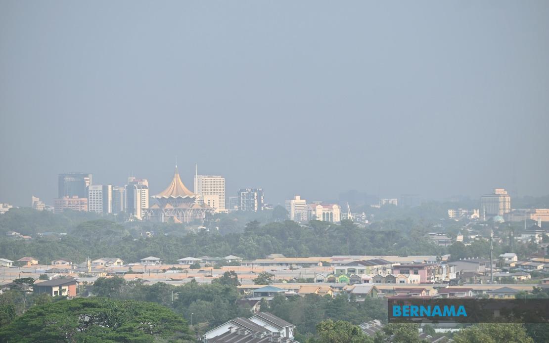
Sarawak faces an extended period of oppressive heat and dryness stretching into the final week of August, according to a forecast issued by the Malaysian Meteorological Department on Wednesday. The prolonged hot spell, expected to persist until August 20, carries serious implications for air quality across the eastern Malaysian state and threatens to undermine visibility across multiple sectors, from transport to outdoor activities and public health.
The meteorological authority attributed the sustained heat to two converging factors: the prevalence of southerly wind patterns channelling warm air across the region, and an elevated concentration of hotspots detected throughout Borneo. This combination creates conditions favourable for smoke generation and atmospheric haze accumulation, particularly acute in southern Sarawak where the risk is deemed most pronounced. The persistence of these hotspots—whether from agricultural burning, land clearing, or other sources—suggests that immediate intervention to control fire activity remains critical to mitigating air quality deterioration.
The air quality impact is already evident across the nation. As of 10 am on August 14, the Malaysian Meteorological Department's monitoring infrastructure detected unhealthy Air Pollutant Index readings in ten locations nationwide, with the majority concentrated in Sarawak. This clustering underscores the regional concentration of haze and pollution stress, raising concern among public health officials, environmental advocates, and residents accustomed to cleaner skies. The unhealthy threshold places vulnerable populations—children, the elderly, and those with respiratory conditions—at elevated risk of illness.
The forecast presents a complex meteorological situation where opposing weather systems are simultaneously affecting different regions of Malaysia. While Sarawak endures heat and aridity, the northwestern peninsula experiences the opposite extreme. MetMalaysia issued thunderstorm and heavy rainfall warnings encompassing the entirety of Perlis, Kedah, Penang and Kuala Lumpur, with the alert extending through the early afternoon of August 14. This bifurcated weather pattern reflects the intricate monsoon dynamics that govern Malaysia's equatorial climate, where distinct wind regimes can produce starkly divergent conditions across relatively short distances.
The threatened areas in the northwestern region extend beyond the federal territories and peninsular states to encompass several districts in Perak. Kerian, Selama, Larut Matang, Manjung and Bagan Datuk all fell within the warning zone, alongside multiple constituencies in Selangor including Sabak Bernam, Kuala Selangor, Klang, Petaling, Gombak and Hulu Selangor. The geographical spread of the thunderstorm warning reflects a broad-based atmospheric instability affecting the western coast, where converging air masses and heightened moisture create conditions ripe for convective activity.
For residents and authorities across the affected areas, the divergent weather warnings necessitate different preparatory responses. In Sarawak and fire-prone regions, the extended heat spell demands intensified vigilance regarding ignition sources and smoke-generating activities. Environmental agencies and local governments must balance economic interests against air quality imperatives, a perennial challenge in regions where agricultural expansion and forest clearance create both economic opportunity and environmental liability. Continued monitoring of hotspot distribution and rapid response protocols for detected fires remain essential to preventing deterioration into hazardous air quality episodes comparable to severe transboundary haze events witnessed in previous years.
Conversely, northwestern Malaysia's residents should prepare for intense rainfall and potential flooding in low-lying areas. Thunderstorm warnings typically accompany gusty winds, reduced visibility, and lightning risk, presenting distinct hazards for motorists, construction sites and outdoor workers. The temporal precision of these warnings—with expiry times specified to the hour—demonstrates MetMalaysia's commitment to real-time public information, though the brevity of some warning windows underscores the rapid evolution of weather systems in the tropics.
For Malaysian travellers, particularly those navigating between regions or flying to affected areas, the divergent conditions pose scheduling complications. Visibility constraints in Sarawak may affect air operations, while thunderstorms in the northwest could delay ground transportation and disrupt logistics networks. The air quality situation in Sarawak carries particular implications for the broader Southeast Asian context, as transboundary haze has historically affected neighbouring Indonesia, Brunei, and cross-border regions, sometimes escalating into regional diplomatic incidents when air pollution reaches crisis proportions.
MetMalaysia has directed the public to maintain vigilance through multiple information channels, including its official website, social media accounts, and the myCuaca mobile application. This multi-platform approach reflects contemporary public communication strategies, ensuring information accessibility across diverse demographic segments regardless of digital literacy or platform preference. Timely, accurate weather intelligence remains foundational to public safety and operational planning across transportation, agriculture, energy and disaster management sectors.
The meteorological forecasts underscore the importance of sustained environmental management and climate adaptation strategies across Malaysia. As regional temperatures edge upward over decadal timeframes, the frequency and intensity of heat waves may increase, potentially extending haze seasons and exacerbating air quality challenges. Policymakers, environmental agencies and communities must integrate long-term climate projections into planning frameworks, moving beyond reactive crisis management toward proactive mitigation of heat-related and air quality risks.

