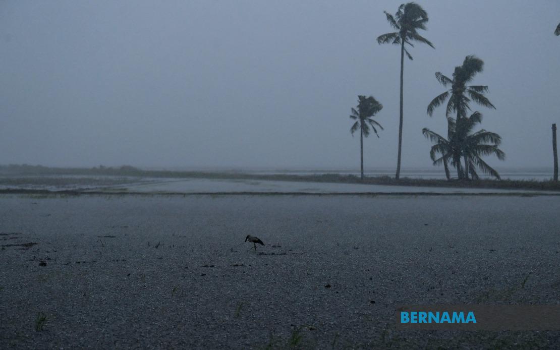
The Malaysian Meteorological Department has issued an urgent weather alert across a broad geographical swathe of the country, warning of dangerous thunderstorm conditions accompanied by heavy downpours and strong gusty winds that could persist until 2 pm. The warning underscores the department's concern about rapid atmospheric destabilisation affecting both peninsular Malaysia and the northern region of Sabah, requiring residents and authorities in the affected areas to remain vigilant during the alert period.
In Perak, the forecasted severe weather is expected to sweep through three distinct regions: Kerian, Bagan Datuk, and Hilir Perak. These areas, which form part of the state's coastal and riverine lowlands, are particularly susceptible to flash flooding when heavy precipitation coincides with strong winds that can impede drainage. Residents in these districts should be prepared for potential disruptions to transportation and outdoor activities during the warning window.
Selangor faces similar threats in two key locations: Sabak Bernam and Kuala Selangor. Both areas lie within the state's northern corridor and are home to considerable agricultural and residential populations. The combination of thunderstorms and heavy rainfall poses risks to low-lying communities and could temporarily isolate some settlements if road networks experience waterlogging.
Negeri Sembilan's south-central districts of Jempol and Tampin have also been designated as vulnerable zones. These regions experience significant monsoon influences during certain periods, and the convergence of moisture-laden air masses with strong wind shear can rapidly generate severe convective weather systems capable of producing torrential rainfall within short timeframes.
Melaka, traditionally one of Malaysia's more flood-prone states due to its low-lying topography, is watching closely over Alor Gajah and Jasin. These inland and coastal-adjacent areas have experienced inundation in previous extreme weather events, making this latest alert particularly significant for local emergency management authorities and residents with historical flood exposure.
In Johor, Kota Tinggi has been placed under alert status. This southeastern district frequently bears the brunt of convective weather systems and has suffered severe flooding consequences in past episodes. The department's inclusion of Kota Tinggi reflects elevated concern about the intensity and duration of the anticipated rainfall.
Sabah, the nation's largest state by area, faces potentially widespread impacts given the alert's breadth across three distinct zones. The Interior division, encompassing Kuala Penyu and Beaufort, represents a mountainous and heavily forested region where sudden downpours can trigger landslips and flash floods in river systems. The West Coast division—covering Papar, Putatan, Penampang, Kota Kinabalu, Tuaran, and Kota Belud—contains the state's economic and population heartland, meaning disruptions would have outsized effects on commerce, transportation, and daily life. Kudat in the far north completes Sabah's vulnerability profile, rounding out a comprehensive warning that essentially encompasses the state's major inhabited and developed zones.
The Federal Territory of Labuan, the sole federal territory offshore, rounds out the alert geography. This business and administrative hub must prepare for potential maritime and aviation disruptions given the forecast of strong winds accompanying the thunderstorms.
MetMalaysia's decision to issue coordinated warnings across such a wide area indicates meteorologists have detected organised atmospheric instability or converging weather systems capable of producing simultaneously severe conditions across regions normally separated by considerable distance. This pattern typically emerges when monsoon transitions occur or when multiple air masses interact over the Malaysian peninsula and surrounding regions.
Residents across all affected areas are advised to secure outdoor items, avoid unnecessary travel during peak storm hours, and monitor official weather updates. Vulnerable groups including the elderly, young children, and those in flood-prone areas should prepare contingency plans. Local authorities have likely activated emergency protocols to position rescue resources and manage potential flooding hotspots.
The specific 2 pm deadline suggests MetMalaysia's models indicate significant weakening of the convective systems by early afternoon as daytime heating stabilises and the triggering mechanisms diminish. However, residents should remain cautious as weather patterns can occasionally persist or shift unexpectedly, and some areas may experience secondary effects like saturated ground and swollen waterways persisting beyond the official alert period.

