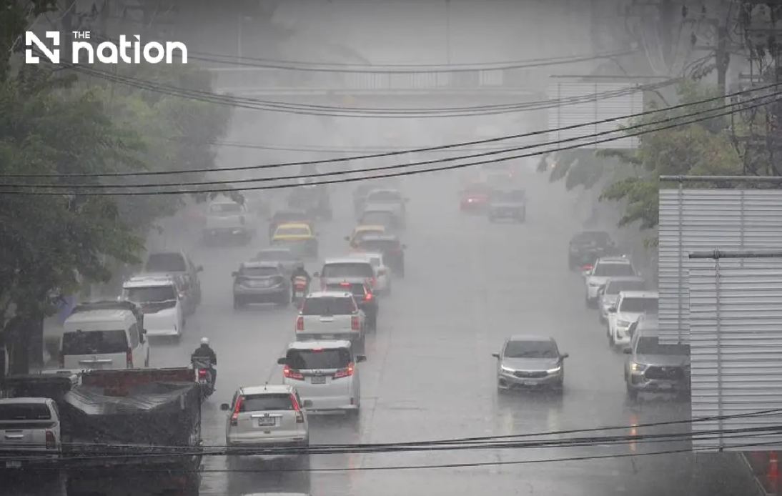
Thailand's weather forecasters issued their ninth severe weather alert on Wednesday afternoon as a monsoon trough combined with strong southwest winds set conditions for dangerous flooding across the country's upper regions through Friday, August 21. The Thai Meteorological Department warned that communities in foothill and low-lying areas face particular vulnerability to flash floods and rapid water drainage as accumulated rainfall threatens to overwhelm natural waterways. The convergence of two weather systems—the northward-moving monsoon trough over northern and upper northeastern provinces paired with an unusually vigorous southwest monsoon circulation across the Andaman Sea and surrounding waters—has created an unusually unstable atmospheric pattern that meteorologists expect will persist through the three-day forecast window.
The northern region faces the most severe conditions, with thunderstorms predicted to blanket 80 percent of the area beginning Wednesday evening through Thursday afternoon. Provinces including Chiang Mai, Chiang Rai, Phayao, Lamphun, Sukhothai, Tak, Kamphaeng Phet and Phichit will experience heavy precipitation, while the mountainous western provinces of Mae Hong Son, Lampang, Nan, Phrae, Uttaradit, Phitsanulok and Phetchabun face forecasts for very heavy rainfall that could rapidly accumulate in drainage basins and valleys. The combination of terrain that naturally channels water toward populated river valleys with the intensity of expected rainfall creates a scenario where flash flooding could develop with little warning, particularly in areas where previous storms have already saturated soil.
Northeastern provinces face similarly widespread threats, with the same 80-percent storm coverage affecting a 12-province swath including Nong Bua Lamphu, Chaiyaphum, Khon Kaen, Maha Sarakham, Roi Et, Yasothon, Amnat Charoen, Nakhon Ratchasima, Buriram, Surin, Si Sa Ket and Ubon Ratchathani. Eight additional provinces including Loei, Nong Khai, Bueng Kan, Udon Thani, Sakon Nakhon, Nakhon Phanom, Kalasin and Mukdahan are forecast to receive very heavy downpours, setting the stage for potential overflow of the Mekong River tributaries that traverse the region. For Malaysian observers, the scale and intensity of this weather system underscores how regional monsoon patterns affect multiple Southeast Asian countries simultaneously, with implications for transboundary waterways and regional flooding patterns that have affected the broader subregion.
The meteorological agency specifically cautioned motorists against attempting to navigate roads with established histories of flooding, warning that temporary inundation could develop rapidly along low-lying routes, particularly in areas where water naturally concentrates. Residents across affected zones were urged to monitor official forecasts continuously and adjust travel plans to minimize exposure to flooded conditions. Authorities emphasized that accumulated rainfall from the preceding days compounds the risk, as soil saturation and stream levels already elevated from earlier precipitation would leave little capacity for additional water absorption or gradual runoff.
Beyond the northern and northeastern zones, the Central region faces thunderstorms across 60 percent of its territory, with heavy rain potentially affecting Nakhon Sawan, Phra Nakhon Si Ayutthaya, Lop Buri, Saraburi, Kanchanaburi and Ratchaburi. The Eastern region will experience even more extensive storm coverage at 70 percent, threatening Nakhon Nayok, Prachin Buri, Sa Kaeo, Chachoengsao and Chanthaburi, while Trat province faces predictions of very heavy precipitation. Even Bangkok and its surrounding provinces, though experiencing somewhat less intense coverage at 60 percent, remain subject to isolated heavy rain events that could briefly overwhelm drainage infrastructure in the capital's low-lying districts.
Maritime conditions present parallel hazards, as the southwest monsoon strengthens wave action across Thailand's coastal waters. The upper Andaman Sea and upper Gulf of Thailand are forecast to develop two to three-meter waves with heights exceeding three meters during active thunderstorm periods, forcing authorities to restrict small vessel operations through August 21. The upper Gulf's wave conditions create hazardous navigation for commercial fishing and transport vessels operating in those waters, while waves along the eastern coast reaching two to three meters will similarly challenge maritime activities throughout the region. This maritime dimension represents an important consideration for the fishing and marine transportation industries that depend upon regular passage through these waters.
The southern peninsula's eastern coast faces less intense but still significant weather impacts, with thunderstorms expected over 40 percent of the territory from Phetchaburi through Surat Thani. Wind patterns will strengthen southwesterly flows reaching 20 to 35 kilometers per hour from Surat Thani northward, while the region from Nakhon Si Thammarat southward will experience more moderate winds of 15 to 35 kilometers per hour. Coastal waves will generally reach one to two meters but will exceed two meters during active thunderstorm passages, creating navigational challenges for smaller vessels throughout the forecast period.
Temperature ranges across all affected regions will remain relatively modest, with overnight lows between 22 and 28 degrees Celsius and afternoon highs between 28 and 36 degrees, depending on specific location and elevation. The relatively cool temperatures combined with substantial moisture content in the atmosphere will sustain the convective processes driving the persistent thunderstorm activity. Southwesterly winds of varying intensities—ranging from 10 kilometers per hour in interior regions to 40 kilometers per hour in coastal areas—will maintain the pressure gradient that keeps moisture flowing toward Thailand's upper regions.
The meteorological department's decision to issue its ninth formal advisory by mid-afternoon Wednesday signals the gravity with which forecasters view the developing situation. Successive warnings throughout a single day typically indicate that conditions are either intensifying beyond initial predictions or that impacts have already begun manifesting on the ground, prompting authorities to escalate alert levels and broaden the geographic scope of warnings. For residents in affected provinces, particularly those living in riverside communities and foothill settlements, this escalating alert pattern serves as a signal to take precautionary measures—securing loose items, identifying evacuation routes, and preparing emergency supplies.
The synergistic effect of two converging weather systems magnifies the flooding threat beyond what either system would produce independently. The monsoon trough's northward progression delivers moisture to the upper regions while the southwest monsoon's vigor maintains strong low-level winds that feed additional moisture into developing storms. This combination creates a scenario reminiscent of some of Thailand's most severe monsoon flood events, where the collision of wet air masses over elevated terrain produces extraordinary rainfall accumulations. Communities in areas that have experienced previous flooding during comparable meteorological configurations face the highest comparative risk, as drainage systems may already be compromised and soil conditions pre-conditioned for saturation.

