When a fast-moving fire threatened his Altadena, California, neighbourhood on January 7, 2025, Matt Blea faced the kind of life-or-death decision that thousands of Californians confronted that week: whether to stay put or evacuate immediately. His choice to leave quickly, made possible by real-time information from a free mobile application called Watch Duty, likely saved his family's lives. The Eaton Fire that swept through shortly after destroyed their home, but the Bleas were already safe. Blea represents one of 2.5 million people who relied on Watch Duty during that catastrophic week, when multiple fires ravaged Los Angeles County simultaneously.
Watch Duty operates through an unusual model combining professional staff with distributed volunteer networks. About two dozen full-time employees coordinate with more than 100 volunteers who constantly monitor emergency radio frequencies, aircraft communications and official agency broadcasts. This lean structure allows the nonprofit to aggregate, verify and distribute information through multiple channels—interactive maps, text feeds and push notifications that override phone silencing features—creating a centralised hub for disaster information. David Hertz, a Malibu resident and fire brigade captain, describes the service as democratising access to emergency data, particularly critical when certain neighbourhoods received minimal official warning before the Palisades Fire claimed 31 lives.
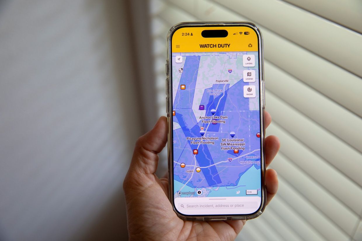
The application's expansion into flood tracking represents a significant strategic shift for the organisation founded in 2021. Watch Duty launched its flooding module in June, just as the American peak flash flood season intensifies, motivated partly by the Texas floods of July 2024 that killed over 130 people and exposed severe communication failures in Hill Country communities and tourist areas. John Mills, the nonprofit's CEO and co-founder, emphasises the urgency of this expansion, noting that traditional emergency alert systems often fail to disseminate critical information across sufficient channels with adequate speed. Mills himself created Watch Duty after receiving no official alerts or evacuation orders when a fire threatened his Northern California home years earlier—a gap between emergent threats and official communication that remains endemic across North America.
The underlying problem extends beyond individual app deficiencies. Official warning systems operate through complex bureaucratic chains where warnings and evacuation orders must navigate multiple government agencies, decision-makers operating under intense pressure, and communication bottlenecks that fragment information across disconnected platforms. While the United States maintains established alert mechanisms via text messages, radio broadcasts and other channels, these systems require human judgment at critical moments and often fail to reach vulnerable populations effectively. Mills identifies a core dysfunction: necessary information frequently exists but remains scattered, difficult to access or presented in jargon that confuses rather than clarifies.
Watch Duty addresses this fragmentation through what Mills describes as centralised information curation. The organisation now employs approximately 300 volunteer "reporters" who collectively scan radio scanners, satellite imagery, weather cameras, citizen-contributed content and official announcements. This distributed verification network checks information against multiple sources before disseminating it through the platform's five available languages. Pete Curran, a retired firefighter now serving as Watch Duty meteorologist, emphasises the speed advantage: volunteers focused exclusively on monitoring and listening often disseminate critical updates faster than official agencies simultaneously managing incident response, logistics and broader emergency operations. The app's design philosophy eliminates the need for users to navigate weather service websites, emergency management portals and county announcement systems separately.
The flood-tracking expansion leverages existing data infrastructure while introducing new monitoring capabilities tailored to hydrological hazards. Watch Duty now integrates National Weather Service flood warnings and watches, real-time river gauge readings from the US Geologic Survey, and potential dam or levee failure notifications. Users can preview their specific flood risk through FEMA-designated flood zone mapping and understand threshold levels at local river gauges. The customisation features allow residents to receive notifications when water levels approach dangerous heights at specific monitoring stations, transforming abstract weather forecasts into personally relevant early-warning systems. Dr Lori Moore-Merrell, former US Fire Administrator and current Watch Duty board member, emphasises that climate change is producing rainfall patterns in regions experiencing such events for the first time, making situational awareness increasingly vital.
The nonprofit's financial sustainability demonstrates strong donor and institutional confidence. Watch Duty received nearly US$6 million in grants and donations during 2025, reflecting recognition that the organisation fills a critical gap in American emergency communication infrastructure. This donor-supported model deliberately avoids advertising or paid features, maintaining the principle that life-safety information should remain freely accessible. The nonprofit structure also builds public trust more effectively than commercial alternatives might, particularly when users must make rapid decisions based on platform information. With over 20 million registered users, Watch Duty has achieved scale comparable to many government agencies while maintaining volunteer-driven local verification networks.
However, Watch Duty's leadership explicitly acknowledges that mobile applications cannot resolve all dimensions of emergency communication failures. Chad Berginnis, executive director of the Association of State Floodplain Managers, emphasises that warnings prove ineffective unless residents understand how to respond—knowing evacuation routes, possessing transportation resources and having practiced emergency procedures beforehand. The Texas floods revealed that information gaps extend beyond data availability; many communities lack clear evacuation plans, accessible transportation for vulnerable populations, or organised practice drills that build muscle memory for decision-making under panic. Berginnis stresses that technological solutions cannot substitute for basic preparedness infrastructure including community-level planning, communication drills and accessible transportation resources.
Another vulnerability undermining digital alert systems stems from declining investments in foundational weather and emergency monitoring infrastructure. Federal and local agencies face proposed budget cuts that threaten the National Weather Service operations, NOAA satellite capabilities and local emergency management staffing levels that ultimately feed data into platforms like Watch Duty. Berginnis warns that without sustained funding for these government systems, the underlying information infrastructure deteriorates regardless of application sophistication. Paradoxically, the most vulnerable communities often lack reliable cell coverage or smartphone ownership that would allow accessing digital alerts, making traditional NOAA weather radios and broadcast emergency systems equally critical.
Mills emphasises that Watch Duty functions as a supplement rather than replacement for established government weather and emergency response infrastructure. Users should simultaneously enrol in local emergency alert systems, maintain NOAA weather radios and develop household emergency plans independent of any single technology platform. This redundancy principle reflects realistic assessment of disaster communication: no single channel or system reliably reaches all populations under all conditions. The integration of multiple complementary approaches—traditional broadcast alerts, mobile app notifications, social media updates and community-based communication networks—creates resilience that individual solutions cannot achieve.
For Malaysian and Southeast Asian readers, Watch Duty's expansion reflects growing recognition across the developed world that centralised information sharing during climate emergencies reduces casualties and property losses. Southeast Asia experiences monsoon-driven flooding affecting millions annually, yet many countries lack equivalent real-time monitoring platforms. The Watch Duty model—volunteer networks, radio monitoring, rapid verification and multi-channel dissemination—could theoretically adapt to regional flood and typhoon hazards, though implementing such systems requires investment in communication infrastructure, volunteer coordination networks and institutional cooperation that remains fragmented across many Southeast Asian jurisdictions. The case demonstrates both the value and limitations of technological solutions to climate risks; applications are tools amplifying existing systems rather than substitutes for sustained investment in emergency management capacity.
The expansion also underscores how climate change is creating new disaster categories in regions previously experiencing different hazard profiles. Mills notes that unprecedented rainfall patterns are producing flooding in traditionally arid areas unaccustomed to such events, overwhelming both community preparedness and official response capacity. This reality applies acutely to Southeast Asia, where changing rainfall patterns may alter traditional flood cycles in unpredictable ways. Communities that have historically managed monsoon flooding may face novel conditions—altered timing, intensity or geographic patterns—for which existing warning protocols and infrastructure prove inadequate. Watch Duty's approach of continuous monitoring, rapid information verification and personalised notification systems offers one template for addressing such evolving threats, though implementation would require regional adaptation reflecting local geography, communication infrastructure and institutional capabilities.

